The WALLABY survey

The Widefield ASKAP L-band Legacy All-sky Blind surveY (or WALLABY) is one of a number of surveys that are now running on the Australian SKA Pathfinder (ASKAP), which is an innovative imaging radio telescope located in an extremely radio quiet zone (the Inyarrimanha Ilgari Bundara, Murchison Radio-astronomy Observatory) in Western Australia. The aim of WALLABY is to use the powerful widefield phased-array technology of ASKAP to observe half of the Southern Hemisphere in the 21-cm line of neutral hydrogen (or HI) at 30-arcsec resolution (with a simultaneous 12-arcsec zoom mode for selected, previously-known galaxies), thereby detecting and imaging the gas distribution in hundreds of thousands of external galaxies in the local Universe. This will allow astronomers to gain a much improved understanding of the processes involved in galaxy formation and evolution, and the role of stellar and black hole feedback, gas accretion and galaxy interactions in these processes. WALLABY has concluded two Pilot Survey phases which covered nearly 400 square degrees of sky around nearby galaxy groups and clusters with the full ASKAP-36 array, as well as a number of early science fields with smaller numbers of antennas. Full WALLABY survey observations started in late 2022.
Observing parameters
| Parameter | Value | Unit |
| Maximum baseline | 2 (6) | km |
| Angular resolution | 30 (12) | arcsec |
| Sky coverage | 14,000 | deg2 |
| Number of ASKAP tiles | 552 | |
| Integration time per tile | 2 × 8 | h |
| Redshift range | 0 – 0.1 | |
| Frequency range | 1295.5 – 1439.5 | MHz |
| Frequency resolution | 18.5 | kHz |
| Velocity resolution (at z = 0) | 3.9 | km s−1 |
| RMS flux density sensitivity (0.1 MHz) | 0.7 | mJy |
| RMS column density sensitivity (0.1 MHz) | 1.7 × 10¹⁹ | cm−2 |
Sky coverage plots
- Interactive sky coverage plot (external link)
- List of WALLABY survey fields (external link)

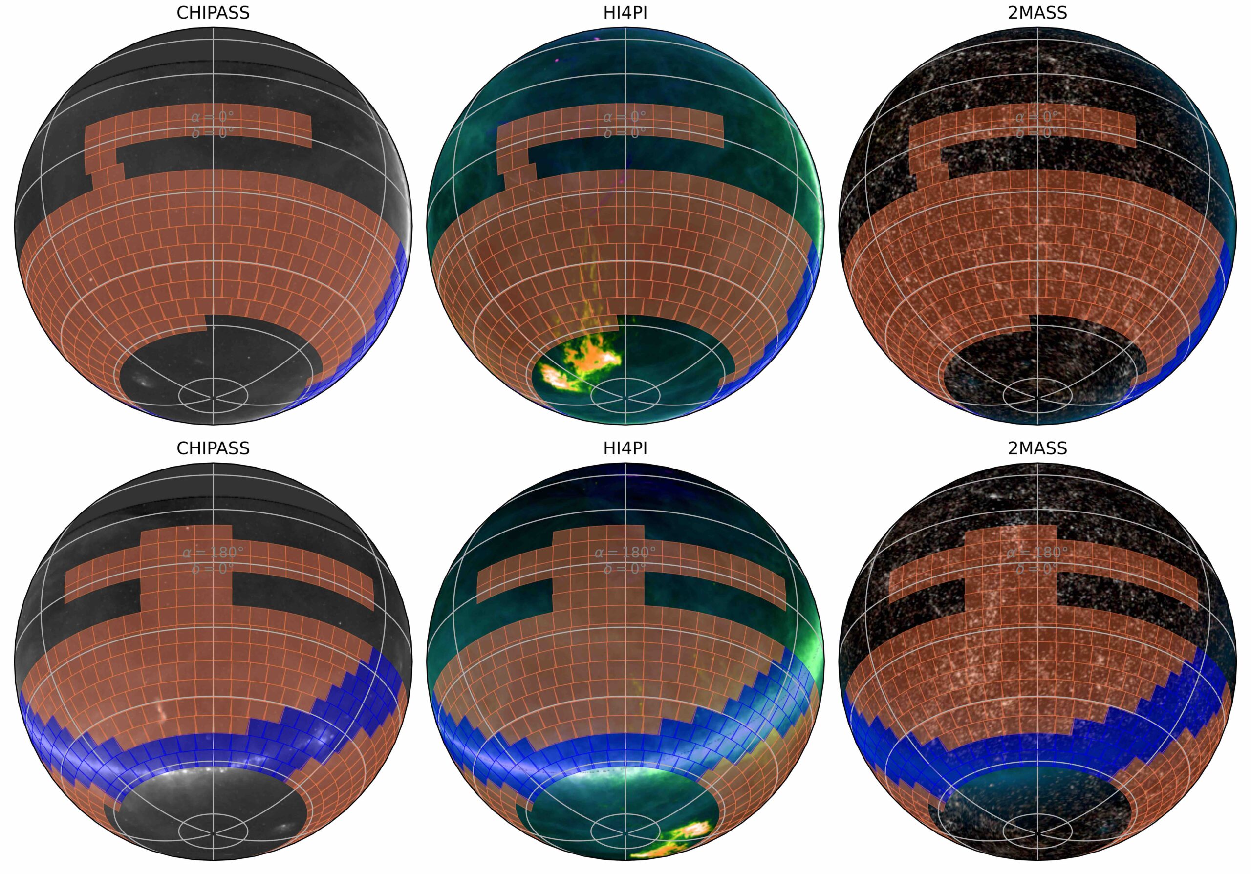
WALLABY full survey tiles, superimposed on various sky maps (CHIPASS, HI4PI and 2MASS extended sources). The central meridian is at RA 0° in the upper row and RA 180° in the lower row. Tiles in blue indicate the Zone of Avoidance.
Central positions of each footprint for the WALLABY full survey, superimposed on the second generation digitised sky survey (DSS2) image. Green and blue markers indicate high priority tiles that can be observed and processed with the current ASKAPsoft pipeline and workflow. Red markers indicate tiles that contain bright continuum sources that can be observed once more improvements are made to the ASKAPsoft pipeline that will enable better continuum subtraction.


